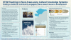
Design and Development of Transmedia Narrative-based Curricula to Engage Children in Scientific Thinking and Engineering Design (Collaborative Research: Ellis and McGinnis-Cavanaugh)
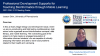
Principal Investigator:
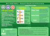
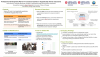
Transforming Engineering Education in Middle Schools (TEEMS) is an NGSS-aligned middle school curriculum that utilizes heroic stories to engage students in learning engineering and science concepts.
Our curriculum consists of multiweek units covering Principles of Engineering Design and Materials, Tools, and Manufacturing, as well as six shorter integrated engineering/science lessons.
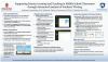
Click image to preview:
Discipline/Topic:
Target Audience: